
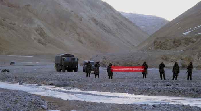
After five decades of status quo in their unresolved border issue, India and China have locked horns again, this time at Galwan Valley. With the first casualties in nearly 53 years, this face off is essentially becoming a cause for concern among people. While the BJP-led government is out to squeeze the last drop of publicity through their toxic ultra-nationalism, almost all of the national and regional parties have been unequivocal in condemning China’s actions. The criticisms have mainly complained about Modi’s lack of vigorous action by way of any response.
But unless we are blinded by territorial nationalism, there will of course be the more skeptical readers who are ready to look at the problem before jumping to any conclusions. For them it is worth doing a brief review of the Indo-China border dispute and its origin. For convenience, we shall break up the article chronologically, so we can cover the issue from the Shimla convention of 1914 down to the Galwan face off of 2020. It is indeed hard to put in every piece of such a vast puzzle in the limited space of an article, but let’s try to find out some solutions, so we can take a more rational stand on the recent crisis.
How the Dispute Originated
The Border issue between India and China is as unresolved in the eastern sector as it is in the western, but in the light of recent developments we will try to focus on the western sector of the Line of Actual Control (LAC). In the contested area of the western sector lies a sparsely populated, rugged, and inhospitable mountainous terrain. While a number of treaties, notes and correspondences have transpired between the several parties (namely, the Ladakh-Tibet treaty of 1684, the Dogra-Tibet treaty, the Note of the British to the Chinese authorities in Tibet, correspondence between the governor of Hong Kong and the Chinese authorities in Canton, Britain’s Note to China in 1899, the Shimla convention, etc.), in most cases either there was no agreement or China refused to accept any treaty because of Independent Tibet representation (Shimla Convention).
To be specific, the question of any official border demarcation or delimitation never occurred to the local or Chinese authorities, as the territories were clearly separated by a vast tract of no-man’s-land. Until British strategic interests came into play (mostly vis-à-vis the advance of Russia’s empire), the arrangements were in fact quite simple and vague, unaccompanied by any detailed historical map. The first map which had any real precision, viz. the map of 1899, was nevertheless unilateral and never officially recognized by the Chinese government. If that map had to be followed, Aksai Chin would be partially incorporated into Britain’s possessions with the border running through the ridge of Lak Tsang, while the other half would be shown as a part of Tibet in accordance with Britain’s strategy of using Tibet as a buffer state between their sub-continental possessions and Russian expansion.
The interesting point is that this map was produced (mistakenly!) by the Indian government after 1947 to extend their claim over the whole of Aksai Chin (although the map transfers a significant share of territory into Chinese hands). The best summary of events that transpired during the British period would be to say, “the Sino-Indian Border was never officially delimited with the participation of the relevant parties”. The unilaterally demarcated borders were never based on the national interests of either China or India. They were based solely on the interests of British investment. In accordance with Britain’s perceptions, the perceived border waxed and waned over the decades. Apart from the point of Karakoram Pass where China placed a border demarcation in late 19th century, the other areas were never been settled, and this uncertain legacy was to be passed on to the successor states in India, Pakistan and China as a colonial residue after the departure of the colonialists.
Developments after 1949
Conditions after the end of empire were quite different. Instead of being a merely strategic issue for the former colonial power, it was now an issue of demarcating the extent of the national territories of two newly independent nations. A permanent solution of the border question was thus more necessary than ever before. A possible way out was to remove the contentious British legacy from the negotiating table and delimit the borders based purely on ground realities and historical connections. While China repeatedly stated that it regarded the Indo-Chinese boundary arrangements as invalid (they never accepted those), India was quite reluctant to open negotiations as it viewed the colonial maps as an acceptable representation of its national territory. Instead, Nehru’s government formulated the “Forward Policy” to contain the Chinese threat, following in the footsteps of India’s colonial masters. This decision would become a tremendous factor in future in leaving the Border issue unsolved. As the government of India refused to accept any negotiation on the question of further delimitation of boundaries (although these had never been delimited before), a series of events forced it into a border war, and no solution ever seemed to be easy again. Finally, from 1962 to date, the Line of Actual Control has been the de facto border between India and China. In the west, Aksai Chin remains a region under Chinese administration, while it is of course claimed by India as hers. In the eastern sector it is the reverse. But to be specific, these are mere claim lines, at best de facto boundaries, not officially delimited international borders.
The Question of Incursion and a Misguided Opposition
In a non-negotiated border, incursions are common phenomena. As different sides have their own logic and maps to show, what counts as an incursion in India’s view can easily be construed by the Chinese as China’s ‘patrolling of our own territory’. In recent times, unilateral decisions like the abrogation of article 370 and division of the state of Jammu and Kashmir into two union territories, coupled with the constant development of military infrastructure in a region of volatile multi-party dispute, can obviously make all neighbouring states anxious. If we add India’s current alignment with the Trump-led US government, the Chinese side is bound to react in one way or another. But our opposition parties also seem to have signally failed to understand the problem. Instead of pressurizing the government to go to the negotiating table and finally settle all outstanding issues, they are in war-mode. It turns out to be a cheap publicity stunt for the political establishment to sway public opinion in favor of violent confrontation, as India’s vast population has never actually seen the agony of war first-hand. This kind of misguided opposition in a time of crisis makes the situation even grimmer (the same happened in the 1960s, with the parties in reverse roles). In the end, the issue is simple. India and China have never officially delimited the boundary between their respective states. Hence, the only solution lies in a delimitation of boundaries, free from the ghosts of the colonial past and based on practical ground realities and mutual respect between the states. Though it seems to be a far cry at the moment to expect such a peaceful solution under the current regime that rules India (for ultra-nationalism is seen by this goverment as an asset), nevertheless that’s the only way forward to a peaceful future. It is up to us to decide between a peaceful, negotiated border and some utopian map in the geography books which is drawn with the blood of our people on it.